Monday, August 25, 2014

Mount Eisenhower - NH

I woke up thankful we had only hiked the Carter Range and not included the Wildcat Range.  My legs were tired, I could feel the 14 mile hike from yesterday, but I had enough drive and energy to knock another 4000’er down.

Taking Edmands Path was certainly a wise decision.  It was a moderate 3.3 miles to the summit, gaining about 2750 ft.  During the course of the hike, I cannot recall any particularly interesting aspects.  However, when we started approaching tree line, there were the occasional outlooks through the trees.  In one of these outlooks, we caught a glimps of the Cog Railway making its ascent up Mt. Washington.  Unfortunately for those people, there was a giant cloud at about 5500’ elevation, so they probably weren’t able to see much from the top…

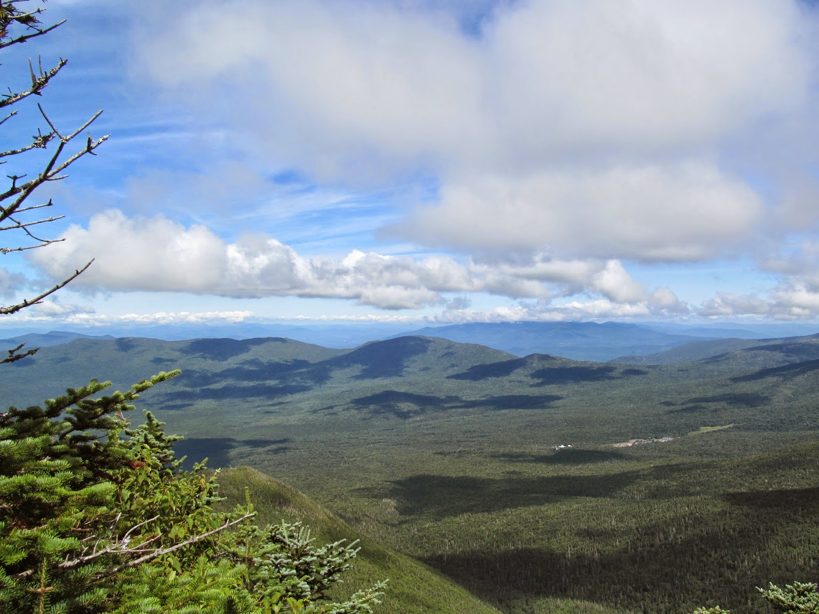
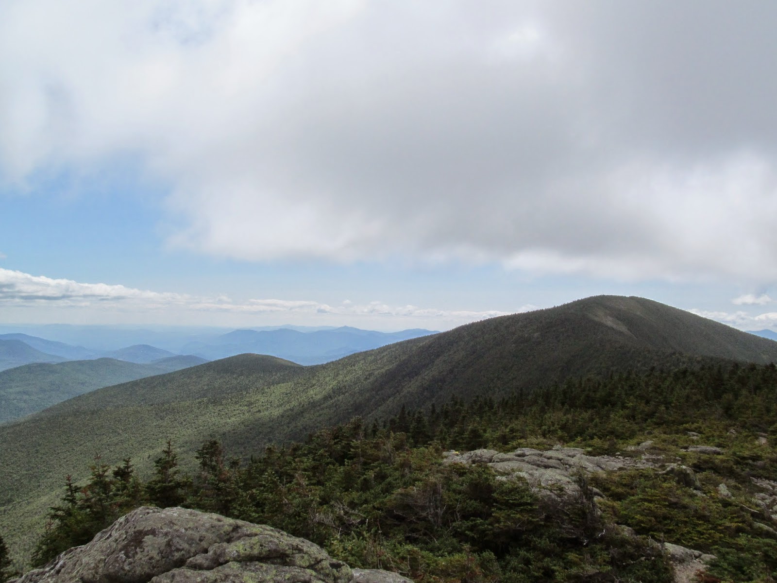
Mt. Eisenhower stands at 4760’, but is dwarfed by Mt. Washington to the north.  Regardless, there are fantastic views from the summit.  Even with decent visibility (we reached the summit with some thick cloud cover blanketing the higher peaks of the Preisdential Range) we were able to see to the Franconia Ridge, possibly even the Green Mountains of Vermont! 


Photogenic Alpine Couple
Always reassuring

Tim with his 'Gansett 
Mountain blueberries and cranberries.  Yum!
Heading up to the summit
Diapensia


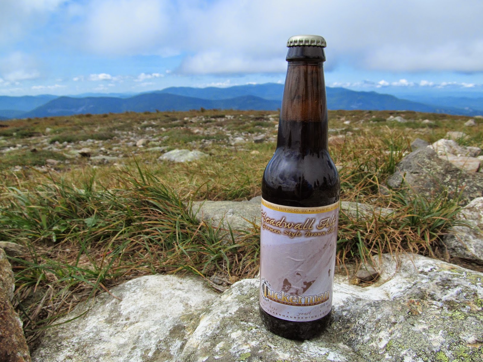
My brew of choice for the day was another Tuckerman, this time of the Amber Ale variety.  Similar to their Pale Ale, this was a very drinkable, enjoyable beer.  I personally enjoy…  well all beer I suppose.  But when I’m in the mood for a nice amber ale, I’ll certainly look for Tuckerman to satiate my desire.

Mt. Eisenhower
            Views – 4.5 (Fantastic views, but would have been better without clouds.)
            Time – 4 (Perfect hike for half-day)
            Difficulty – 2.5 (One of the more moderate hikes out there)
            Beer – 4.5 (Tuckerman Amber Ale)
            Overall – 4.5 (Great views, nice and quick, all around great hike)


Next up: Mt. Jackson (with Mt. Webster).  In the mean time, please comment/ask questions about my adventures.  When I don’t do a hike for a week or so, what would provide you with a solid bridge between hiking posts?  Please help me make this blog better and more enjoyable for you!

Friday, August 22, 2014

The Carter Range - NH

About a month ago, after hiking the Tripyramids with Tim, we made plans to, weather permitting, hike again in late August.  His internship was ending and I have Monday-Wednesday off.  Not only did the weather permit, it promoted hiking!  So for the last three days, Tim and I have done quite a bit of hiking in the White Mountains.  Each day brought a different hike, so this post will focus on our first hike – the Carter Range.

To the east of the Presidential Range lies the comparatively tiny Carter mountains.  That said, there are three 4000’ mountains in this range: South Carter (4420’), Middle Carter (4600’), and Carter Dome (4832’).  Our trip took us up the Nineteen Mile Brook Trail to Zeta Pass.  From there, a left took us to both South Carter and Middle Carter.  We then turned around, retraced our steps up and over South Carter to tackle Carter Dome and its shouldering peak, Mt. Hight.  Mt. Hight was actually the only summit with a panorama view.

The route we took was well thought out (thank you Tim) and as easy on our legs as possible.  Through a rather moderate grade, we hiked our merry way along what I would presume to be the Nineteen Mile Brook.  There were some beautiful cascades along the trail.  Our trail eventually split off from the brook and led us up toward South Carter.  There were only two difficult aspects to this hike: finding the official summit of Middle Carter and the 14+ miles of hiking.  We’re fairly certain the reason we were able to do more hiking was due to the frigid temperature of the Saco River soothing our fatigued legs.


Cascade on the Nineteen Mile Brook Trail


Carter Dome and Mt. Hight waiting for us.

South and Middle Carter from Mt. Hight

Carter Dome from Mt. Hight

Clouds blanketing the Presidential Range


The Wildcat Range


At the summit of South Carter
At the summit of Middle Carter

At the summit of Carter Dome

We were contemplating throwing in the Wildcat range as well.  This would have only added another mile or so to our trip, but a few extra thousand feet of elevation gain.  We definitely made the right decision to cop out at the Carter hut and head back down the Nineteen Mile Brook trail.

While on the top of Carter Dome, I enjoyed a Tuckerman Pale Ale.  I found it crisp, drinkable, and slightly aromatic with a gentle hop flavor.  Very enjoyable whilst drinking in front of Tuckerman’s Ravine.


The Carters
            Views – 3.5 (A few outlooks, but only good views from Mt. Hight)
            Time – 3.5 (14 miles in about 10 hours?  It was a long day, but we made solid time)
            Difficulty – 4 (No grade challenges.  14 miles of hiking is exhausting though)
            Beer – 4.5 (Tuckerman Pale Ale)
            Overall – 4 (OK views, but the time and effort was worth the three 4000’ers)

Stay tuned!  Tim and I hiked Mt. Eisenhower on Tuesday, so I’ll start working on that post in the near future.  In the mean time, please comment/ask questions about my adventures.  When I don’t do a hike for a week or so, what would provide you with a solid bridge between hiking posts?  Please help me make this blog better and more enjoyable for you!

Wednesday, July 30, 2014

Camel's Hump - VT

I knew I was going to hike today.  The weather was forecasted at a high of 75oF and partly cloudy.  My biggest problem was deciding where to go.  It would be nice to hike in the Adirondacks, maybe a day trip to the Whites?, or how about one of the mountains in VT closer to where I live?  So I mulled this over while I made myself a breakfast sandwich and jammed out to my Gorillaz Pandora station.  Feel Good, Inc. came on, and I knew: “City’s breaking down on a camel’s back”.  Camel’s Hump!  It had been about three years since my last hike (Tim and I had plans in late March/early April, but car issues thwarted them).

Camel’s Hump is one of the most popular hikes in Vermont.  The trailheads are only a short ways off of Route 2, the road running right along Interstate 89.  The Monroe Trail and Burrows Trail are both rather easy and can be done by most any skill level.  I decided to hike something a bit different and took the Long Trail via Monroe Trail and Dean Trail.  Total, this hike was about 8 miles.

It started with the casual hike through the woods on the Monroe Trail for about a mile and a half.  Other than woods, there is not very much scenery on this trail.  On the Dean Trail, there were a few rivers that I crossed and a few open swamps with views of some of the surrounding mountains.  It wasn’t until the Long Trial that the intensity of the hike picked up.  The Long Trail passed over a few of the smaller mountains to the south of Camel’s Hump.  All the while, you can see the southern cliffs of Camel’s Hump’s summit looming large in the distance.  On a few occasions, I caught myself thinking ‘How on God’s green Earth am I getting up THERE!?!’  I pushed through and got to the brutal final push: about 800 feet in half a mile.

I got to the summit at a perfect time.  There were some clouds in the distance, but nothing too ominous.  Just a short while before I summated, it looked as though there were clouds swarming the summit.  On the way down, it got really cloudy for the better part of an hour. 
 
Open area off Dean's Trail

Camel's Hump from the Long Trail

I have to get up there!?!


Mansfield in the distance

At the summit of Camel's Hump

My summit buddy!

This guy wanted to hike down with me


My summit beer this hike was Otter Creek Copper Ale.  For whatever reason, I was not a huge fan (sorry Otter Creek!).  It tasted like a brown ale but not as sweet and caramel-ly.  Oh well.  I’d still drink another one.


On my last post, my sister thought it would be a good idea to rate the hikes on a few different areas.  The scale is 1-5 with 1 being the worst, 5 being the best (NOTE: Beer does not factor into overall).  I will also include my two previous 4000’ hikes:

Tripyramids
            Views – 2.5 (Some beautiful views from the slides, but nothing at the summits)
            Time – 5 (Two 4000’ in one hike and I was back before dinner)
            Difficulty – 4.5 (VERY steep)
            Beer – 4 (Samuel Adam’s Rebel IPA)
            Overall – 4 (A very fun hike, but the lack of views detracts from its greatness)
Mount Ellen
            Views – 2 (Looking down a ski lift)
            Time – 4 (Maybe I was running, but it only took a few hours)
            Difficulty – 2 (No areas of real challenge)
            Beer – 4.5 (Magic Hat #9)
            Overall – 3.5 (Probably a one-and-done hike.  Mediocre views with none to the west)
Camel’s Hump
            Views – 4.5 (Lake Champlain, the Adirondacks, the Green Mountains, even the Whites!)
            Time – 3.5 (Some instances of “are we there yet?”)
            Difficulty – 4 (Long Trail was grueling.  Monroe is a 2)
            Beer – 3 (Otter Creek Copper Ale)
            Overall – 4.5 (Great views, good fun, decent beer though)


I hope you have been enjoying my updates.  Maybe you have a question about one of my hikes, an idea about how I could improve this blog, want to leave words of encouragement, or want to hike with me some time?  If you have any comments, feel free to leave post them!

Tuesday, July 22, 2014

Mount Ellen - VT

I woke up this morning to the sun glaring through the window onto my face.  It was 6:30 on my Saturday Part 2.  Instead of turning over and falling back to sleep, I decided to do something productive and fun, and since I’m writing a new post, you can probably guess what that something was. 

This hike was special for a few reasons.  First, it marked my first solo hike.  On the past Saturday, a few of my friends were in Burlington, so I went to visit them after work.  One of my friends, Sam, and I had a conversation while watching the sunset about hiking.  During this conversation, I brought up my frustration with working the weekend shift: nobody else is free to hike with me.  To this, Sam suggested hiking solo, something I had never thought of doing.  So I followed her suggestion and made it back in one piece!  The other special feature of this hike was my new backpack.  It has more back support and is not ripped at the seams from overuse.

Anyway, I decided to climb Mount Ellen.  I remember hiking it once through the wilderness program at SMC and remembered it being forgettable, ironically enough, but I had to hike it for the Northeast 115.

The Jerusalem Trail was difficult to find.  I even had to ask for directions (yes, I know!  A male stopped for assistance).  At least I had some Led Zeppelin to enjoy on my radio.  It turns out the road sign I was looking for was buried in the middle of a spruce tree.  It turns out that finding the trail was the hardest part of this hike.

It starts with a gradual, about one foot elevation gain for every five feet hiked for close to 2 miles.  Before you merge with the Long Trail after 2.7 miles, the Jerusalem Trail gets a tad bit steeper, but nothing daunting in the slightest.  After merging with the Long Trail, it becomes a 1.6 mile scamper up and down, never gaining or losing more than a few hundred feet at a time.  All the while, there is a thick canopy overhead and minimal views on either side.  Occasionally there is a break in the brush and you can see a bit better, but nothing too spectacular.  Finally, the trail comes to Sugarbush, a ski resort on Mount Ellen.  From here, you can get the best views on the trail.  Unfortunately, there is a chairlift disrupting the view, but it can make for some “artistic” photographs.


My hiking buddy

Ellen about a mile away


At the summit of Mount Ellen


This is not the summit of Mount Ellen.  I REPEAT: The chairlift is not the summit of Mount Ellen.  The Long Trail continues on south, and within 50 feet of entering the woods again, I noticed a cairn that I assumed to be the summit (the trail descends shortly thereafter).


I stayed on the chairlift area for a solid half hour to soak in the views, sun, and a Magic Hat #9.  Their “not quite Pale Ale” is a delicious distinctive tasting beer.  Not very hoppy at all, it has hints of fruit.  Regardless of its flavor, it is delicious and crisp: perfect for the summit of a 4000’ mountain.


Wednesday, July 16, 2014

A Side Hike - Mount Philo

Just because a mountain is not on the Northeast 115 list doesn't mean I cannot and should not hike it.  On a whim, my friends Jon, Sarah, and I went for a hike on the little bump called Mount Philo.  Jon had to work in the afternoon, so there was not enough time to do a bigger hike.  After I had my 5000 mile tune up for my car, I drove down to Burlington to pick them up and we drove down for a quick afternoon hike.

Mount Philo is the perfect family hike.  It is steep enough where you can work up a sweat but are never really exhausted.  The trail is long enough so you feel as though you have accomplished something when you reach the top but still have enough energy to motor around the rather substantial summit area.  The summit area has a campground, some Adirondack chairs and benches, and a beautiful view facing the Adirondacks over Lake Champlain.  The only drawback of Mount Philo is the fee to enter (only $3/person).  Other than that, it is a great little hike for all ages and all skill levels.  Unfortunately, since this trip was spur of the moment, I forgot to grab my camera, so there aren't any pictures.

Now, my favorite part of the hike is the proximity to my favorite brewery: Fiddlehead.  Since this was a quick hike and we had a time limit, I decided not to bring a beer to the peak for my typical hiking beer.  Rather, we stopped by Fiddlehead and sampled some of their brews on tap.  Since they rotate what they brew, what I sampled will probably be different from what is available when you stop by.  That being said, their flagship IPA is delicious.  It has been a while since I last had a pint of it, so it is hard to describe the taste on memory alone.  I suppose you will have to swing by and see what it's all about for yourself!

Thursday, July 10, 2014

The Tripyramids - NH

A few weeks ago, I was sitting at lunch break enjoying my peanut butter and jelly sandwich when I received a text from my friend Tim.  “If you’re not working Saturday, I was thinking of hiking the Tripyramids”, it said.  Unfortunately, I had to do some overtime that weekend.  He followed up with “Two of the 4000’ers in NH.  It’s an 11 mile hike with a section that is supposed to be one of the hardest in The Whites.  At one point it goes up 1200ft in 0.5 miles.”  Instantly, I knew that these were going to lead off my Northeast 115 adventures.

We got on our merry way Sunday, July 6, 2014 early in the morning.  The hike starts with a 3.6 mile casual stroll next to a river, but once you hit the trailhead, the intensity spikes.  After crossing the river, you start climbing steadily through some thick lower brush, and with a turn, you hit the north slide.  This is the section that Tim was talking about: 1200ft gained in 0.5 miles.  All the while, you have great views behind of Osceola and Tecumseh.  The north slide is not for the faint of heart.  To put the 1200ft gained in 0.5 miles into perspective, there were many occasions when Tim and I had to channel our inner Spider Man to move forward.  At one point, I grabbed a place on the trail for leverage and realized I was standing rather straight.  Although brutal, the ascent went rather quickly.  Once we reached the top of the slide, it was another 15 minutes or so of hiking up a trail until we reached the summit of North Tripyramid.  The summit area was rather small and, with a few other parties there, quite crowded, so Tim and I decided to mosey on over to the Middle Tripyramid summit.

After a short descent, a conversation about how badly the Red Sox are playing, and a quick climb, we found ourselves on the summit area of the second 4000' peak of the day.  This summit had slightly better views and wasn't nearly as crowded, so we decided to stop for lunch: the best tasting sandwich and some GORP.  Fully energized, we made our way to the south summit to start our final descent.

Similar to the north slide, the south slide was very steep.  However, the south slide was mostly gravel so traction was hard to come by.  Before too long, the trail leveled off and slowly worked its way back to the main trail.  Another 2.6 miles and we were back to the car and on our way home.  I would highly suggest following the same route Tim and I took (although there is a trail that goes around the north slide for those who are afraid of steepness).  The footing on the north slide was much better and not once was I afraid of slipping and/or falling.  That being said, if the weather is at all unfavorable, you should probably avoid the rock slides.  They become very slippery when wet and you are fully exposed to the elements.

Unfortunately, all of the summits are closed, but there are still lookouts and plenty of views from both of the slides:

 
North Tripyramid in the distance

The ascent

Tecumseh to the left and the Osceolas straight ahead


At the summit of North Tripyramid

At the summit of Middle Tripyramid


Overall, this was one of the most fun hikes I have completed.  When I hike a steep trail that forces me to use my hands, I almost forget that I am exhausted.  Even better, the loop trail provides two 4000’ summits and different scenery with every step.  The Tripyramids were definitely a great day hike.


Most impartant, this hike was brought to you by Samuel Adam’s Rebel IPA.  Rebel IPA is a West Coast IPA; 6.50% ABV.  I found this a very tasty, refreshing beer at the summit of Middle Tripyramid.  It was hoppy, but not aggressively so.  There were also some sweet notes of fruit that mixed in delightfully with the bitterness of the hops.  In short, would I drink it again?  Of course!


If you like what you read (or even if you don't), feel free to comment.  What would make the post better?  What was your favorite part?  What didn't you like in particular?  Again please let me know what would make my blog more interesting for my viewers.