Monday, August 25, 2014

Mount Eisenhower - NH

I woke up thankful we had only hiked the Carter Range and not included the Wildcat Range.  My legs were tired, I could feel the 14 mile hike from yesterday, but I had enough drive and energy to knock another 4000’er down.

Taking Edmands Path was certainly a wise decision.  It was a moderate 3.3 miles to the summit, gaining about 2750 ft.  
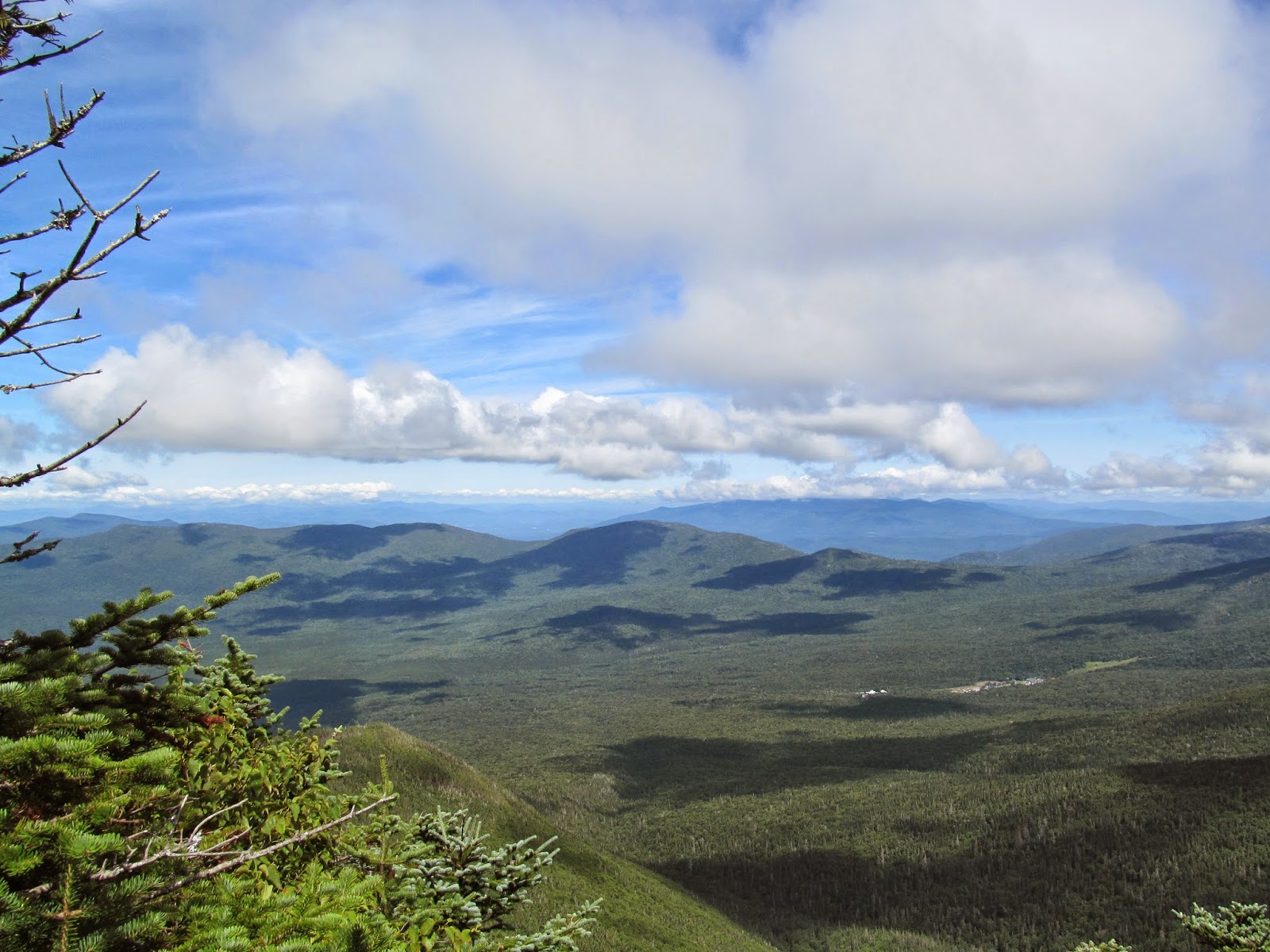
During the course of the hike, I cannot recall any particularly interesting aspects.  However, when we started approaching tree line, there were the occasional outlooks through the trees.  In one of these outlooks, we caught a glimps of the Cog Railway making its ascent up Mt. Washington.  Unfortunately for those people, there was a giant cloud at about 5500’ elevation, so they probably weren’t able to see much from the top…

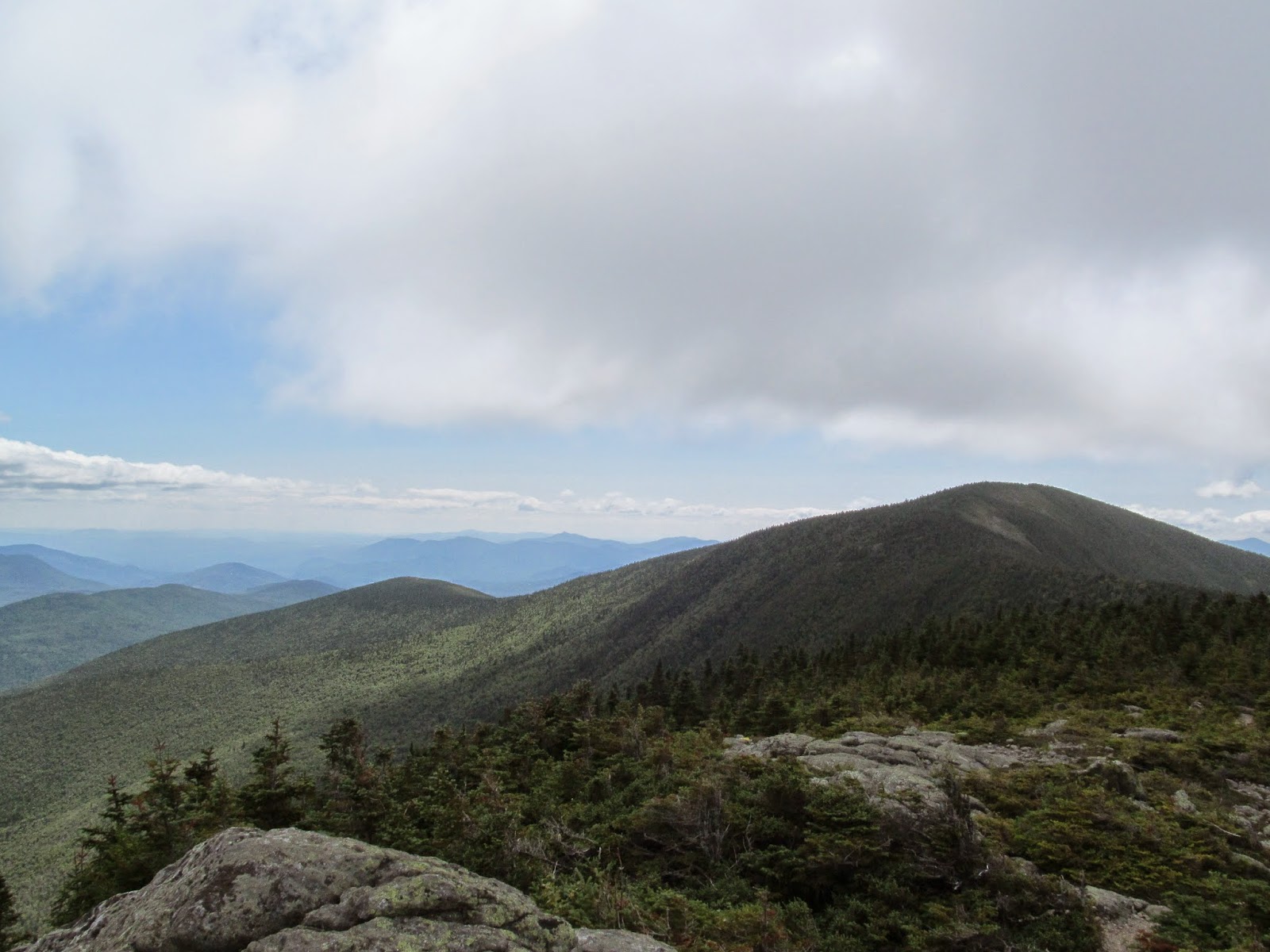
Mt. Eisenhower stands at 4760’, but is dwarfed by Mt. Washington to the north.  Regardless, there are fantastic views from the summit.  Even with decent visibility (we reached the summit with some thick cloud cover blanketing the higher peaks of the Preisdential Range) we were able to see to the Franconia Ridge, possibly even the Green Mountains of Vermont! 


Photogenic Alpine Couple
Always reassuring

Tim with his 'Gansett 
Mountain blueberries and cranberries.  Yum!
Heading up to the summit
Diapensia


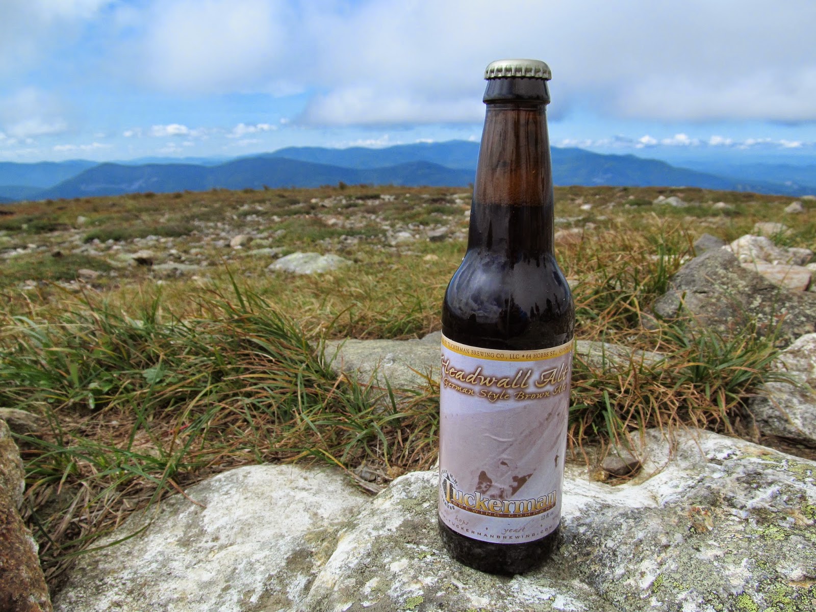
My brew of choice for the day was another Tuckerman, this time of the Amber Ale variety.  Similar to their Pale Ale, this was a very drinkable, enjoyable beer.  I personally enjoy…  well all beer I suppose.  But when I’m in the mood for a nice amber ale, I’ll certainly look for Tuckerman to satiate my desire.


Mt. Eisenhower
            Views – 4.5 (Fantastic views, but would have been better without clouds.)
            Time – 4 (Perfect hike for half-day)
            Difficulty – 2.5 (One of the more moderate hikes out there)
            Beer – 4.5 (Tuckerman Amber Ale)
            Overall – 4.5 (Great views, nice and quick, all around great hike)


Next up: Mt. Jackson (with Mt. Webster).  In the mean time, please comment/ask questions about my adventures.  When I don’t do a hike for a week or so, what would provide you with a solid bridge between hiking posts?  Please help me make this blog better and more enjoyable for you!

Friday, August 22, 2014

The Carter Range - NH

About a month ago, after hiking the Tripyramids with Tim, we made plans to, weather permitting, hike again in late August.  His internship was ending and I have Monday-Wednesday off.  Not only did the weather permit, it promoted hiking!  So for the last three days, Tim and I have done quite a bit of hiking in the White Mountains.  Each day brought a different hike, so this post will focus on our first hike – the Carter Range.

To the east of the Presidential Range lies the comparatively tiny Carter mountains.  That said, there are three 4000’ mountains in this range: South Carter (4420’), Middle Carter (4600’), and Carter Dome (4832’).  Our trip took us up the Nineteen Mile Brook Trail to Zeta Pass.  From there, a left took us to both South Carter and Middle Carter.  We then turned around, retraced our steps up and over South Carter to tackle Carter Dome and its shouldering peak, Mt. Hight.  Mt. Hight was actually the only summit with a panorama view.

The route we took was well thought out (thank you Tim) and as easy on our legs as possible.  Through a rather moderate grade, we hiked our merry way along what I would presume to be the Nineteen Mile Brook.  There were some beautiful cascades along the trail.  Our trail eventually split off from the brook and led us up toward South Carter.  There were only two difficult aspects to this hike: finding the official summit of Middle Carter and the 14+ miles of hiking.  We’re fairly certain the reason we were able to do more hiking was due to the frigid temperature of the Saco River soothing our fatigued legs.


Cascade on the Nineteen Mile Brook Trail


Carter Dome and Mt. Hight waiting for us.

South and Middle Carter from Mt. Hight

Carter Dome from Mt. Hight

Clouds blanketing the Presidential Range


The Wildcat Range


At the summit of South Carter
At the summit of Middle Carter

At the summit of Carter Dome

We were contemplating throwing in the Wildcat range as well.  This would have only added another mile or so to our trip, but a few extra thousand feet of elevation gain.  We definitely made the right decision to cop out at the Carter hut and head back down the Nineteen Mile Brook trail.

While on the top of Carter Dome, I enjoyed a Tuckerman Pale Ale.  I found it crisp, drinkable, and slightly aromatic with a gentle hop flavor.  Very enjoyable whilst drinking in front of Tuckerman’s Ravine.


The Carters
            Views – 3.5 (A few outlooks, but only good views from Mt. Hight)
            Time – 3.5 (14 miles in about 10 hours?  It was a long day, but we made solid time)
            Difficulty – 4 (No grade challenges.  14 miles of hiking is exhausting though)
            Beer – 4.5 (Tuckerman Pale Ale)
            Overall – 4 (OK views, but the time and effort was worth the three 4000’ers)

Stay tuned!  Tim and I hiked Mt. Eisenhower on Tuesday, so I’ll start working on that post in the near future.  In the mean time, please comment/ask questions about my adventures.  When I don’t do a hike for a week or so, what would provide you with a solid bridge between hiking posts?  Please help me make this blog better and more enjoyable for you!